Portneuf River Back Country Horsemen
  • Home
  • Membership
  • MAPS
    • Caribou NF, Westside RD Trail Locations
    • Tetons and Palisades Areas
    • Trails in East Idaho
    • Apps to plan trips and navigate in the backcountry
    • Major Backcountry Maps on the Internet
    • GPS education
  • CALENDAR
  • PROJECTS
  • SCRAP BOOK
  • FRIENDS
Picture

Picture

Idaho Parks and Recreation Maps 
Emphasize Trails

There are 27 beautiful state parks in Idaho.

Interactive Trails Map
Idaho State Parks

​You can create a track and print a geo referenced PDF map but not download a GPX file.
Each park has its own map.

Colorado Trail Explorer 

BLM Utah Ineractive Map

Picture

​by USGS   U.S. Geological Survey

​USGS Topographical Maps: These classic "Topo" maps are free and printable but not editable. They are in a GeoPDF format. Read the "How to ?" instructions at the top of the web page.​The terrago plugin for Adobe Reader allows the user to learn about the amazing properties of GeoPDF maps.
​The Avenza Mapping App lets you load these GeoPDF maps.

NATIONAL FORESTS

U.S. Forest Service Interactive Map ​
Emphasize Trails​

U.S. Forest Service Downloadable Maps
​These are the best if you are in a national forest.
The Avenza Mapping App will open 
geo-enabled PDF

​
​​​

​​​​ 
Picture

NATIONAL PARKS

Glacier National Park​

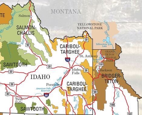
Grand Teton National Park

Yellowstone National Park

Picture

REI Guide to
​National Parks

WILDERNESS

Click on a wilderness and then click on read more to find out regulations.

Frank Church River of No Return Wilderness

Bridger Wilderness

​​

Major State and National Trails

Continental Divide Trail

Nez Perce National Historic Trail
Great Western Trail

Other Public Places

City of Rocks and Castle Rocks, Idaho

​​Campgrounds, monuments, byways, recreation areas, rental cabins, wild and scenic rivers, state parks, wildlife management areas, wildlife refuges, National trails

​Geologic Map of Idaho
COTREX
​
​You can create a route and download a GPX file but no printing available.
Utah Map
Frustrating map. Does not show trails, only trailheads. Start by clicking on the layers icon (three stacked sguares) and turning all the layers off. Then choose your background map (four squares). After that just explore the features.​​
USGS Interactive Map
Download USGS Topo Maps
USFS Interactive Map
Download USFS Topographical Maps
You will be taken to a interactive map called "Forest Series." There will also be tabs with a home selection and 7 other series, none of which is the original Forest Series. This is confusing because you might find yourself unable to get back to the Forrest Series.
Free Downloadable Maps
Horse Information
Horse Information
Horse Information
National Parks Guide
Wilderness Connect
Users can give Feedback on Condition of Trails
Horse Information
Map
Information and Map
Map
Horse Information
publiclands.org
Geologic Map of Idaho

[email protected] or [email protected], (208) 352-0523 
​Making the Back Country better by keeping trails open and groomed for all user groups.

Picture