
|
|
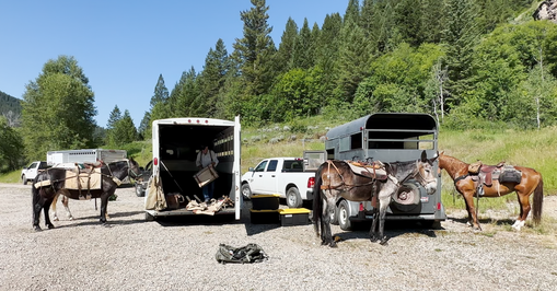
Portneuf River Back Country Horsemen packed supplies for the Palisades Ultra Trail Race this July.
|
Outdoor Dinner MeetingJoin the Portneuf River Backcountry Horsemen chapter on Tuesday, September 12th at 6:30 pm at the Ross Park upper Pavilion. (come at 6:00 pm for set up) We will have a presentation by Hannah Sanger, Pocatello's Manager of Science and Environment. She will describe how the Portneuf to Peaks Collaboration aims to improve our local trails.
|
Main meat dish will be provided as well as home made root beer and lemonade. For the potluck, those whose last names start with any letter from A to G bring a salad, those whose last names start with H to O bring a vegetable dish and those whose last names start with a letter from P to Z bring a dessert.
|
This August 8th, our educational speaker will be Kylie Hoffer an equine dentist with Snake River Equine Services |
|
|
Here is a local group with a balanced view of outdoor recreation.
The Advocates for Multi-Use of Public Lands are interested in protecting the Teton and Palisades Backcountry. This video was copied from their website https://www.teamampl.org/ Their philosophy is one of a cooperation between recreational users needs and environmental concerns.
DEDICATED TO THE PRESERVATION OF PUBLIC LANDS AND NATIONAL FORESTS FOR THE BENEFIT OF, AND THE MULTI-USE BY, OUR REGION'S DIVERSE RECREATIONAL COMMUNITIES. Advocates for Multi-Use of Public Lands (AMPL) is an organization made up of passionate recreationists. Our focus includes the organization of public support and the creation of a unified voice to maintain and protect broad access to our public lands for motorized as well as non-motorized recreational uses in a cooperative and cohabitant manner. We believe in the co-existence of recreation and conservation for all.

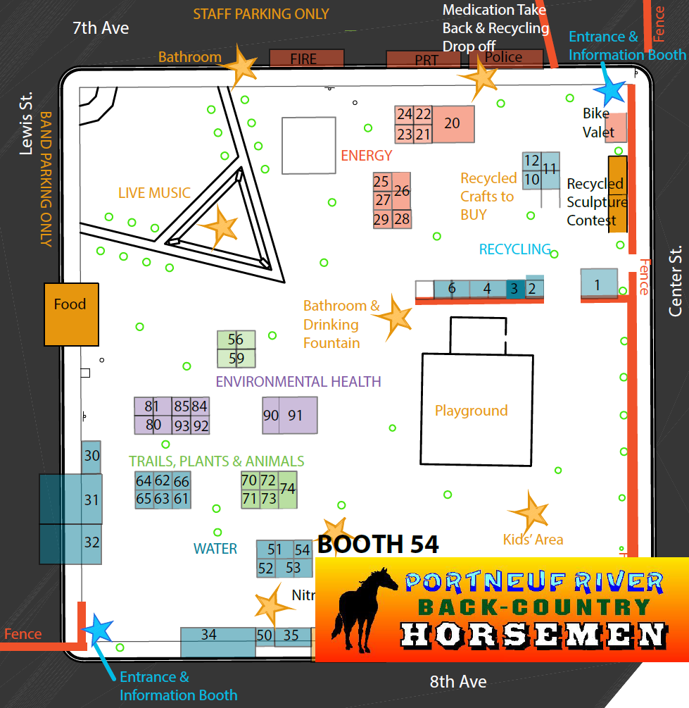
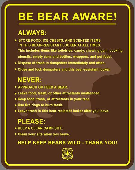
The Portneuf River Back Country Horsemen will be at booth 54. Our theme is "Be Bear Aware."
Black Bears and Grizley Bears can be found in Idaho. We will be providing information to trail users on how to avoid bear problems and enjoy viewing wildlife safely.
Black Bears and Grizley Bears can be found in Idaho. We will be providing information to trail users on how to avoid bear problems and enjoy viewing wildlife safely.
|
|
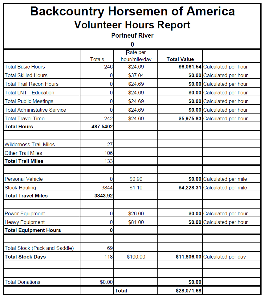
The Mission of Back Country Horsemen is to keep trails open and in good repair for all trail users. Here is our report that was sent to Back Country Horsemen of America.
Past Ride Pictures + Portraits + Events
To see past ride pictures and videos click the link below. It will switch to the Flickr website where there are albums of numerous rides taken by the Portneuf River Back Country Horseman and the Over the Hill Gang (OTHG). If you ride a gaited horse you may want to click FRIENDS in the menu above for more information about the OTHG.
323 Cutshalts Rd, Pocatello, ID (GPS doesn’t always work), North on Yellowstone, Left on Reservation, Right on Hawthorne, Left on Cutshalts, 4th house on the right, White house and shop with green roof.
|
|
AMANDA KUMIKO KENT IS A LEADERSHIP COACH AND TRAINER
|
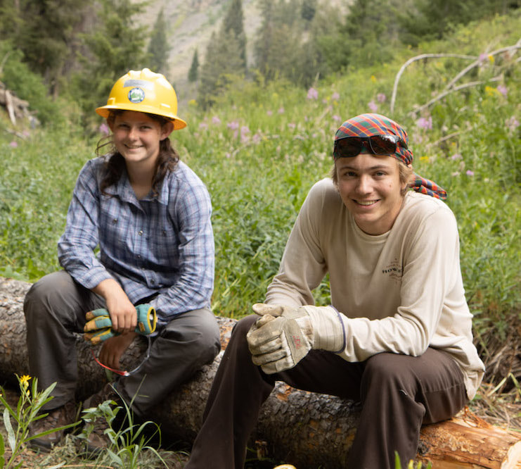
The Idaho Trails Association just recognized one of their youngest volunteers. She just happens to be from Pocatello. Meet Samantha Waldron.
|
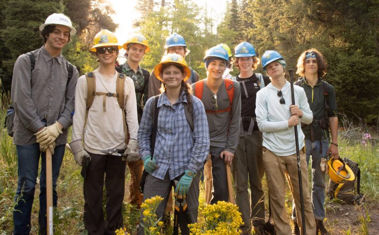
We welcome folks of all ages and abilities to volunteer on a trail crew or behind the scenes to make our trails better for all! Thank you to everyone, from the youngest to the oldest and everyone in between, who makes up ITA’s incredible collection of volunteers!
|
|
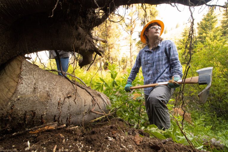
Samantha Waldron is a new ITA trail crew member. While she is certainly not the youngest member to come on an ITA project (babies are welcome on some projects!), she is the youngest to come on her own. She turned 14 just in time to volunteer for our weeklong East Fork Wood River project in the Pioneer Mountains this summer. As part of an ITA Youth Crew trip for people 14-18 years old, Samantha was doing it all: Silky saw, crosscut, Pulaski, McLeod, shovel, loppers, and clippers.
“This work is so important because there are people who want to use these trails and sometimes the trails just aren’t in good enough condition. Since we’re the ones using them, it’s up to us to keep them accessible.” So she and her team cleared brush, removed logs, and moved big rocks so everyone can enjoy these beautiful places. What she likes about the youth trips is getting to meet so many new people. “You work hard, then come back to camp and sit around and get to know people. You get a chance to relax, and then you do it all again the next day. It’s so calm out here, and you can listen to the sound of the birds and the trees and the streams. It’s just so different from the hustle and bustle of city life.” The biggest payoff of all, she says, it that once people get a chance to come out and see the wilderness, they want to do their best to preserve these beautiful places. |
OH NO!
horse flies
mosquitos
ticks
Some summer day you will have forgotten to spray your horse or find out you didn’t have any insect repellant at the trailhead.
An 8 Oz. plastic bottle Backcountry insecticide repellent concentrate can be put in saddle bags for emergency. The oil type is applied full strength and is resistant to being washed off by rain or splashes. The water type can be applied full strength or diluted with water. It is made by our member Stephen Hurley, who was a pharmacist by profession. He is selling the repellent, but all profit will go to the Portneuf River Back Country Horsemen. Available at meetings or events.
website with good starting videos on trail design and repair
Etiquette for trail users (https://youtu.be/gFj3J6YIlzo)
|
|
Finding a Lost Phone
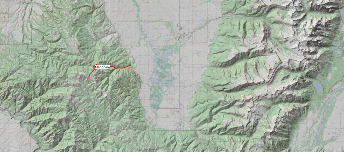
The picture above was taken on the Mahogany Trail looking east toward the Teton Range. The Mahogany Trail is 15 miles long and has 2,800 ft of climbing. The ride is mostly through forest and leads up to a high meadow called Elk Flat. One of the riders showed us a sheep camp where a spring provided pure drinking water for our lunch. For those that want to go further, the ride continues all the way to the top of Garn’s Peak, the highest point in the Big Hole Mountains
On this ride I lost my phone on the trip back to the trailers. Summer growth along the trail was thick. There was no hope of finding the phone by going back up the trail. I was resigned to my fate of being $75 poorer, not having my best ever phone case, somehow getting another phone as fast as possible, the hassle of applying for a copy of my driving license and going to the bank for a new debit card.
It didn't occur to me until I got back to Pocatello that I had used my computer a long time ago to find my phone. I knew there was no time to waste. The phone would be dead before morning. Finding the site on the internet was easy and in no time, I had the phone's location shown on a google map, plus the phones coordinates in latitude and longitude. Because I use Google and my phone is a Samsung the site I used was Google find my Device. The picture below shows what the site looks like. This example is where my phone was while writing his story.
It didn't occur to me until I got back to Pocatello that I had used my computer a long time ago to find my phone. I knew there was no time to waste. The phone would be dead before morning. Finding the site on the internet was easy and in no time, I had the phone's location shown on a google map, plus the phones coordinates in latitude and longitude. Because I use Google and my phone is a Samsung the site I used was Google find my Device. The picture below shows what the site looks like. This example is where my phone was while writing his story.
Well the story has a good and bad ending. The bad part is was I had to drive 4 hours and take another 8-mile ride to get the phone. The good ending is I found the phone safe and sound. It was hidden deep in brush and it would never be found otherwise by anybody. So, if you lose your phone (or someone steals it), get on the computer right away and find its location, either as an address or if off road then with latitude and longitude. You might be mortified to realize that you need the GPS app on your phone to find your phone.
Calling in a Helicopter
Summer 2019: A member of the Over the Hill Gang passed out and fell off his horse. He woke up and was groggy but had no symptoms or signs of cardiovascular, muscular, nervous or mental problems except just general tiredness and weakness. At the time we had no way to measure blood pressure or blood sugar. He had been perfectly well at lunch. Anyway to make a long story short we called in the air ambulance. They didn't find anything either but he was still dozy and weak and unable to ride back to the trailers. So this hilicopter trip is going to cost 56 thousand dollars. A word to the wise is to check your health insurance for such coverage.