
Portneuf River Back Country Horsemen Pot Luck Dinner and Silent Auction
Tuesday, February 20th at 6:30 PM, meeting place: Fish and Game Conference Room, 1345 Barton Road.
To get ready for the auction, we need everyone to search their closets, garages, sheds, etc. for an item to donate that has value for our "Western Way of Life" or that is related to outdoor activities and is in good shape. Please bring items between 5:30 and 6:30 PM, or call Steve Hurley at (208) 221-4626.
Live music by Roy McKee
|
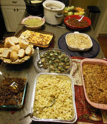
Main entrée, pulled pork and cole slaw will be provided by the chapter. this year, so we are de-emphasizing the need for you to bring food. Instead, bring your family or a friend. However, if you have a favorite side dish, we would be excited to have you bring it.
|
|
There are several versions of CalTopo based on the quantity and quality of printing, details of maps, high resolution aerial imagery, custom layers etc.. The free version is very good for a beginner. The most expensive version, which costs $100 per year, has one feature that the other versions do not have, it allows downloading of map graphics for offline use. This can be done with a computer, laptop, tablet or phone. You can cut your link to the internet or cell service and do map planning deep in the wilderness. The most recent news is that there is a team subscription for $500, This subscription provides the deluxe $100 version to each member, for up to 100 members in the team.
If I could reqruit nine persons to join the initial team with me, then all ten of us would put in $50 toward the license and this would be called the initial fee. Anyone wanting to join the team later would be considered a part year member and would pay the original initial fee of $50, but their money would be saved to the team bank account. At the end of 12 months, the original members could renew or not, and they might be elegible for a partial refund. Part year members would be eligible for a partial refund only if they renewed for the next full year. This would encourage commitement to joining for a whole year and sharing the savings with the whole team.
Refunds to each member would be drawn from the bank account and be based on the following calculation. $500 would be divided by total sum of months that all members were in the team. This would be called the average monthly cost. Then each member would be refunded the difference of the initial fee, minus the product of the number of months they were in the team times the average monthly cost. The money from those part year members who did not renew and did not get any refund would be applied to the next years $500.
I know it sounds complicated and I am sure a few more rules will develop to run the team. However you will have the best app for computers, laptops, tablets and phones. I would be doing this as a service to promote mapping for all backcountry users in Idaho. It would be based out of the Portneuf River Back Country Horsemen Chapter. Call me to learn more. Steve Hurley 208 221-4626
Thirty Day Creek and South Putnam Mountain at the top of this map are on the Indian Reservation. Rapid Creek is on the left side of the map, Topponce Creek is on the right side, and Inman Road is at the bottom. For a working map of this Trail Loop click on this link https://trailmaps.us/McNabb
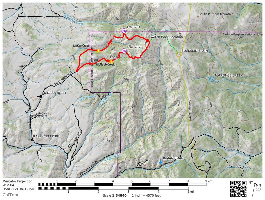
As can be seen by the trail's profile above, the loop is about 7 miles long and has 2000 feet of altitude gain. Physical exertion for the horse is rated at 5 on a scale of 1 to 10. There is moderate rockyness. The average slope is 15% with a small sections over 30%. We got off and walked the horses at times to give them a rest and to stretch our legs. Recommended for an intermediate rider to gain confidence.
It is open cross country riding from the saddle at the top of McKee Creek to the saddle on the top of McNabb Creek. The trail spur to Buckskin Basin is shown in green on the map. Darrel Beard discovered an older abondoned Forest Service trail in the McKee Creek basin.
The area covered by this project is a perfect local getaway that has everything horseback riders love, old groves of Douglas Furs, flowered meadows, towering mountains, clear flowing streams, and views in all directions.
The video graphic below is interactive. you can hold down the left mouse buttom and grab the graphic to tip or rotate it. Scroll your mouse to zoom in and out. Controls on the left bottom can pause and start the action, the slider can be grabbed to move to any location along the trail. On the right bottom there is a box shaped icon. Click on it to open a full screen view. Finally in the upper right, click on STATS for more information.